en

Below you will find a selection of projects that I have realized or accompanied as a geoinformatics specialist since süd.geoinformatik was founded or shortly before.
.I look forward to your project being listed here soon.
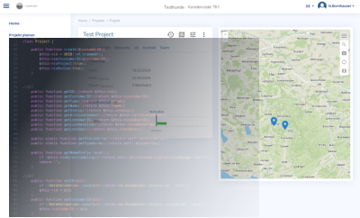
I planned and fully programmed a web application for a laboratory for air pollutant analysis.
The application facilitates the planning, management and execution of sampling projects by the laboratory's customers.
If you are interested, you can test the application at probennahme.ch. Please get in touch with me.
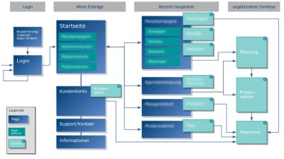
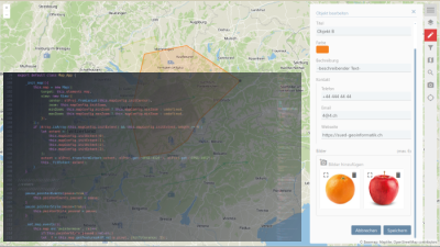
For a federal authority, I planned and programmed a web map application as a central component in a major application for crisis preparation and management.
Several teams were involved in the project and I implemented the map application for integration in different areas of the application in the form of a reusable API.
On the page map apps you can test a shortened version of the web map application yourself. For more details on implementation, please get in touch with me.
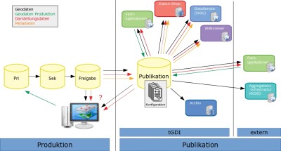
I advised the cantonal administration of St.Gallen on the evaluation of variants for the reorganization of the publication platform.
The main objectives were the reduction and simplification of interfaces and processes between the production/maintenance of geodata and the publication of these data in different applications, e.g. the public geoportal.
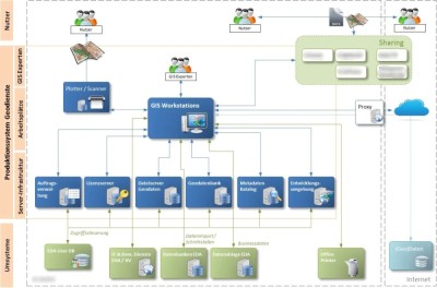
At the Federal Department of Foreign Affairs FDFA, I managed the projects to enhance the geodata infrastructure.
The production platform of the GIS department was to be modernized, formalized and transferred to regular operations.
The aim of the new to be created WebGIS platform was to enable FDFA employees worldwide to access and work with geoinformation.
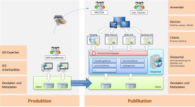
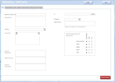
I also implemented a geodata catalog application for the GIS department of the FDFA, which simplifies the management and use of geodata in the FDFA. In particular, it takes into account the specific requirements of international datasets in the FDFA.
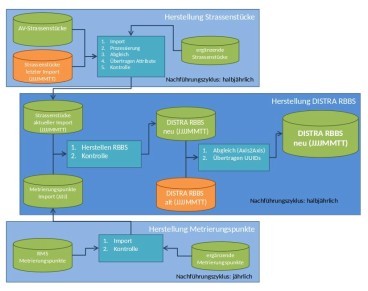
Project management and technical implementation of the project. The canton's road network is realized from cadastral survey data. It integrates linear referencing and specialist networks mapped onto it as well as interfaces to the national road network MISTRA and other specialist applications.